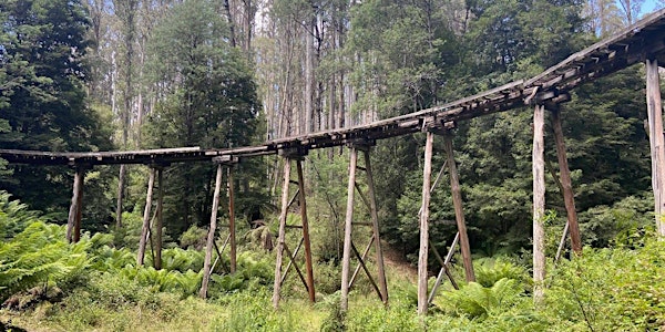
The Rubicon Aqueducts hike is a rather pretty walk with no steep hills, unless you choose the harder option.
The full walk takes about 5 hours, while it’s about 18 km, it’s almost flat and entirely on good tracks, so you will walk faster than usual.
We will walk south along the Royston River Road for 2 km until we get to a road junction. Here we will head downhill parallel to the wood stave pipeline that leads to the pretty Royston Power Station.
Heading south along the tramline for 3.4 km to the Rubicon Dam. This side trip winds it’s way through attractive tall forest on a flat route. There are a couple of attractive bridges, Beech Creek trestle was toasted in the 2009 fire and has been rebuilt, (sadly without tramlines).
The Lubra Creek Trestle has a rotten deck with gaps of a couple of metres that are undecked, so we will descend a side track to the creek to get across the valley. At the end of the tramline take in the atmosphere of the damp gorge and it’s small dam.
A rough trail will lead to the lake for views near the dam wall. The view of both the lake and valley from near the wall is well worth the effort.
At Royston power station we will head north on the tramline beside the aqueduct, walking past a mini sawmill and a house. We will then climb back up to the tramline and walk north beside the aqueduct for 5 km until you get to the forebay at the end of the aqueduct. There was once a small village here with a dozen or so houses. There are still four buildings including a shed for the rail vehicles and a building that houses the huge winch that hauled passengers and freight up the steep incline.
Here will will take in the stunning view from the forebay. This is the place where the open aqueduct feeds into a steep penstock taking the water down to Rubicon power station 450 metres below. We will see the Goulburn Valley and lots more too.
After taking in the view, walk south east up Le Bruns Road for 3km to our cars.
Walking Notes:
Duration: 20kms
Time: 5-6hrs
Start: Royston River and Le Bruns Rd. We suggest that you meet at us in the Healsville Coles Carpark at 8.15am.
Grading: 3 (moderate)
Bring along snacks and lunch plus adequate water for a 5- 6 hour hike.
Getting there: closest town is Taggerty
