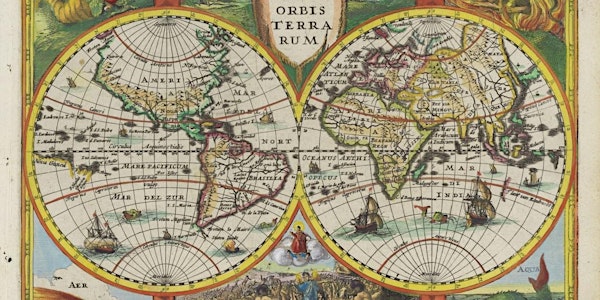
In this lecture, historian of cartography and map expert Chet Van Duzer will examine changing ideas about the Indian Ocean from classical antiquity to the eighteenth century, focusing on how those changes are reflected in maps.
Explore the breakdown of the Ptolemaic idea that the Indian Ocean was enclosed by land; how cartography by the Portuguese, Dutch, French and English shows their attempts to gain power in the Indian Ocean; and why European cartographers depicted the distant Indian Ocean as a home for sea monsters.
Discover rare and precious maps held by collections around the world as well as treasures from the State Library’s map collections as Chet takes you on a tour of Indian Ocean cartography.
Chet Van Duzer is visiting Australia for the ARC funded project ‘Mobilising Dutch East India Company collections for new global stories’ (ARC LP210300960). This special lecture is presented in partnership with the University of Western Australia and the State Library of Western Australia.
Chet Van Duzer
Chet Van Duzer is a historian of cartography and a board member of the Lazarus Project at the University of Rochester, which brings multispectral imaging (a technology for recovering information from damaged manuscripts) to cultural institutions around the world. He has published extensively on medieval and Renaissance maps; his recent books include Henricus Martellus’s World Map at Yale (c. 1491): Multispectral Imaging, Sources, and Influence, published by Springer in 2019, and Martin Waldseemüller’s Carta marina of 1516: Study and Transcription of the Long Legends, published by Springer in 2020. His book Frames that Speak: Cartouches on Early Modern Maps was just published
IMAGE: Typus orbis terrarum, Amsterdam, Johannes Cloppenburg, 1632 Charts a small section of the West Australian coastline marked "t'Land van Eedracht" indicating Dirk Hartog's 1616 discoveries in the ship Eendracht. State Library of Western Australia Collection slwa_b6791496_3
